Discovering the flower fields by bike. Keukenhof, Sassenheim, Hillegom, Lisse – 35km

Flower fields, Keukenhof, nice little villages and polder landscapes – April 2018

Flower field of daffodils near Sassenheim

Summary

This route is a perfect way to watch the flower fields in a relaxed way at close distance. The route has more or less the form of an eight with the Keukenhof in the middle of it. Besides that you come across many colorfull flower fields and the Keukenhof, the route crosses nice polder landscapes and a couple of villages which have a good choice of terraces. Further, underway there is the possibility to do additional activities, e.g. besides the flower exhibition of the Keukenhof to visit the museum dedicated to the history of the flowerfield region, have a flower bulb dinner or visit the Keukenhof estate with its castle (see further below for links). It can be crowded on the route, so going early in the morning or late afternoon is advised. Very well recommended.

Tractor in the field, near Sassenheim

Description trail

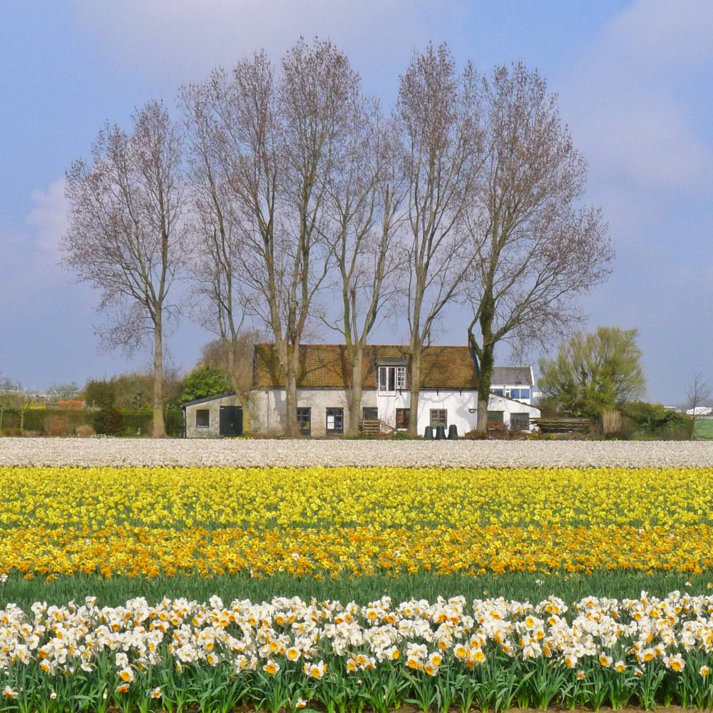
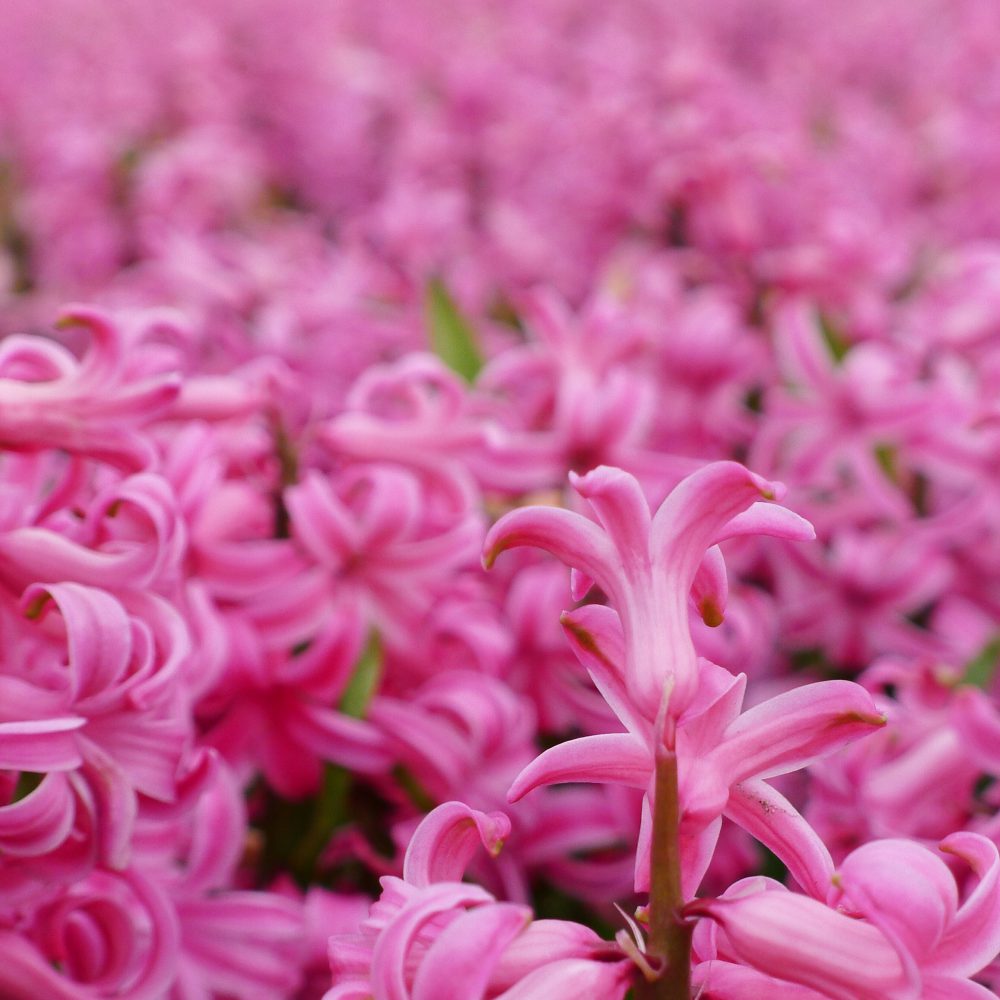
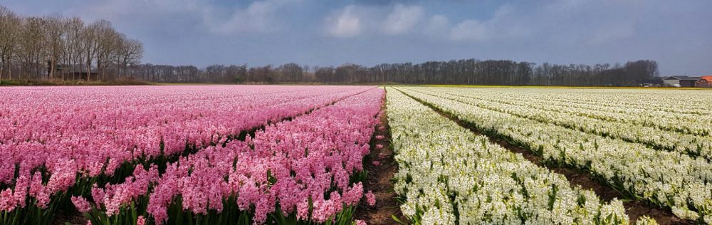
In general, daffodils, hyacinths and tulips are the most common type of flowers that you will find in the flowerfield region. At the start of the flowerfield season, you will mostly see yellow, white and pink since these are the most common colours of daffodils and hyacinths.  A couple of weeks after the daffodils, the tulips will start to flower with in addition the colors red and blue. This year the first fields of daffodil flowers came to blossom around mid april and generally the tulips will be visible later until around mid may. Each year this may differ depending on e.g. how strong and long the winter lasted.

Fields full of hyacinths – near Sassenheim

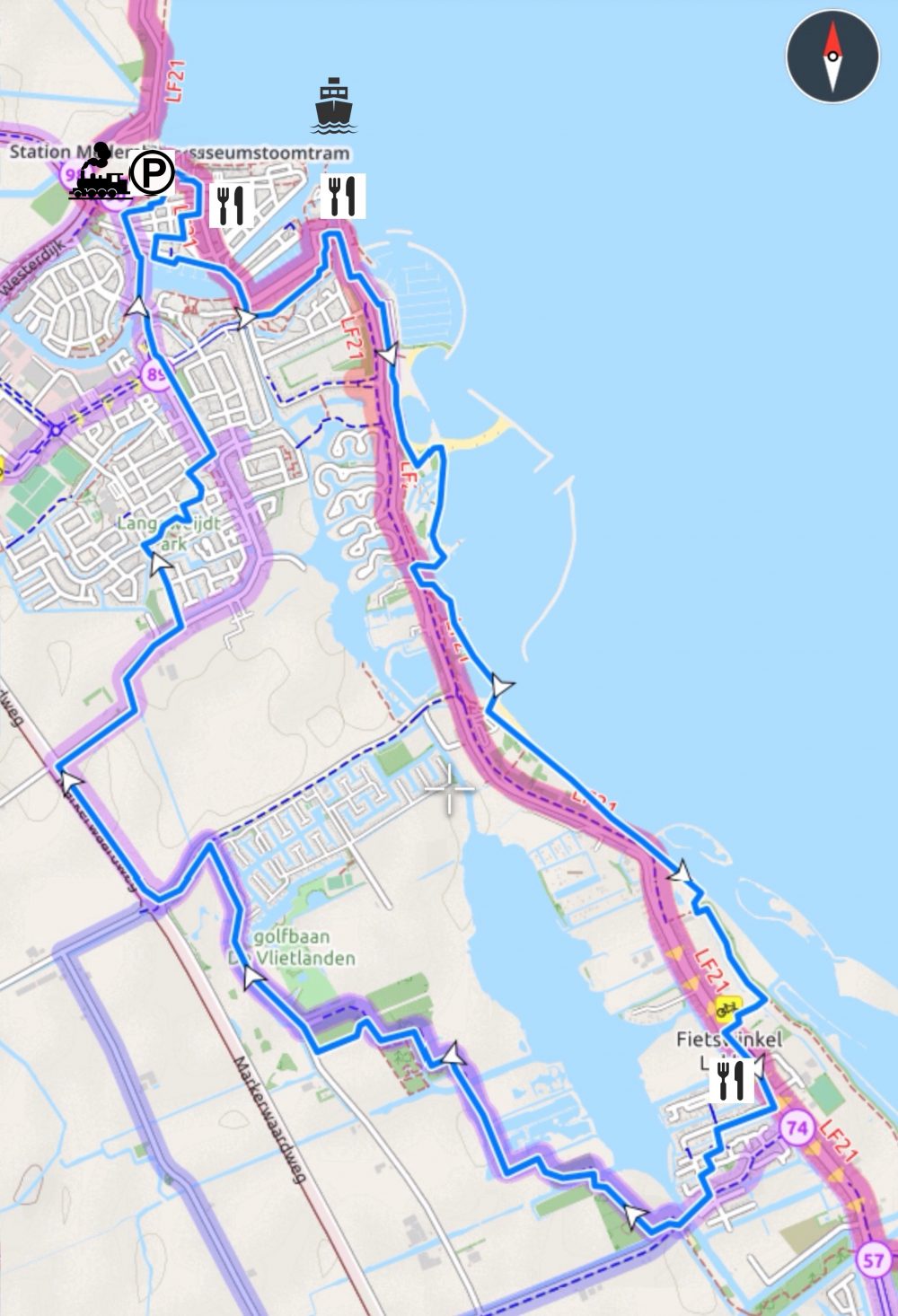
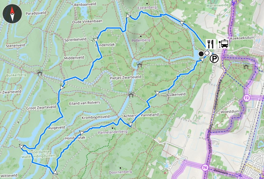
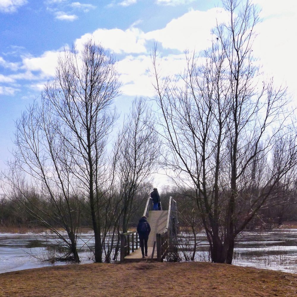
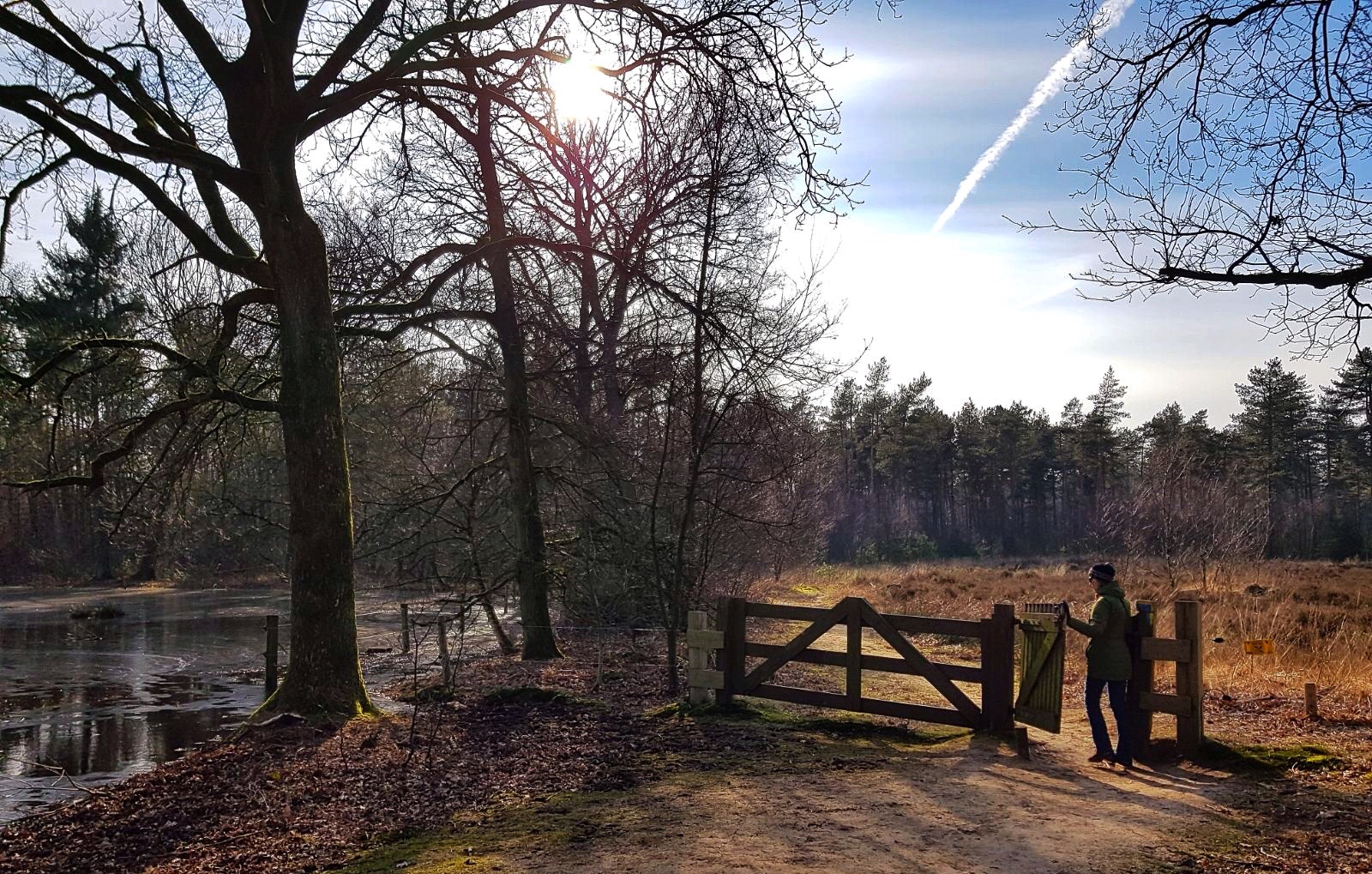
We started at the Sassenheim railway station, knooppunt 51, but you can start at any point in the route. When the train doors opened in Sassenheim, we could immediately smell the hyacinths out there which was a great start. The route first enters the village of Sassenheim but as soon as you leave it, the flower fields pop up.

It is funny to see how much effort people put in taking pictures or selfies. Signs that it is not allowed to enter the fields are massively ignored or even included in the pictures.

Flields with hyacinths – flowerfield near Sassenheim

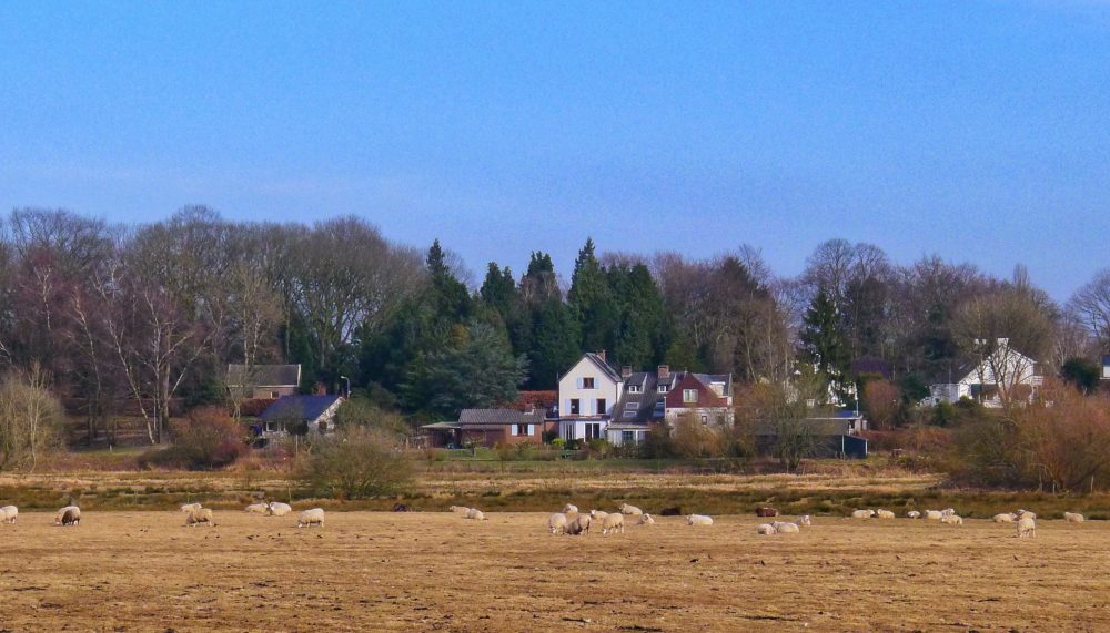
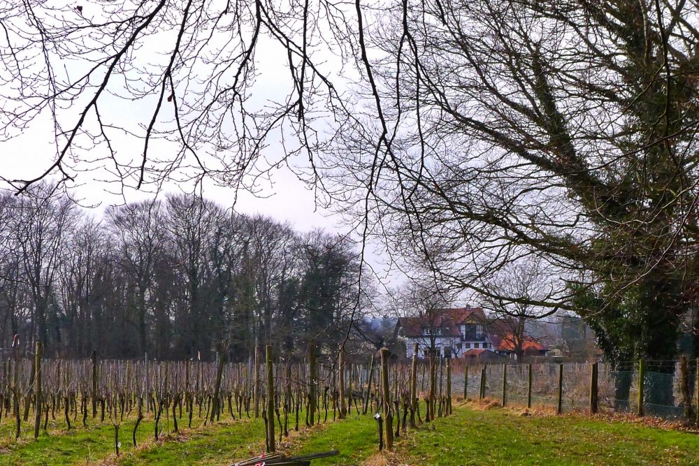
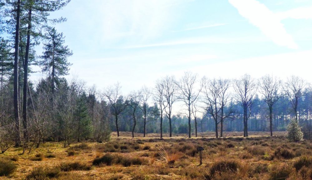
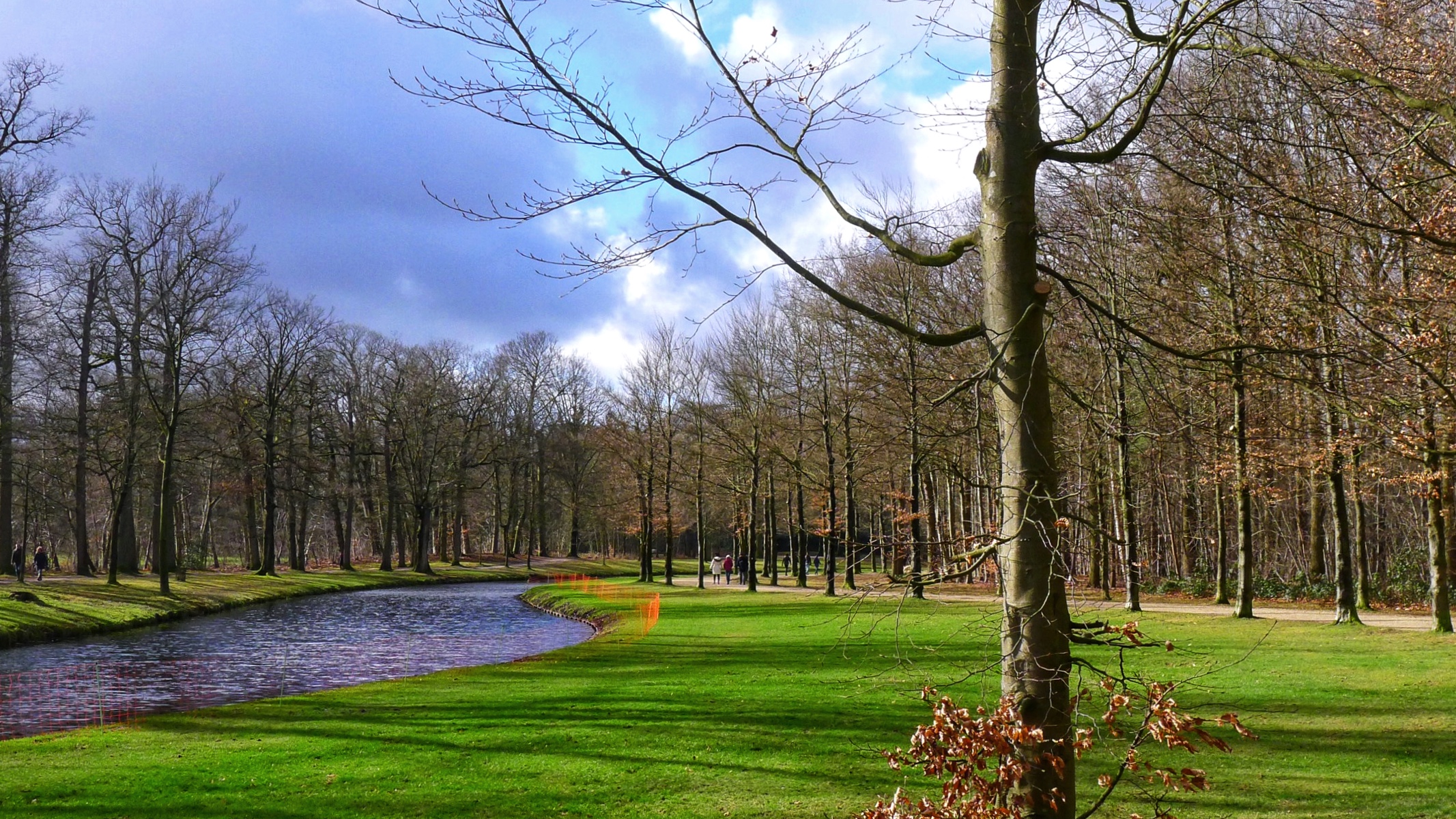
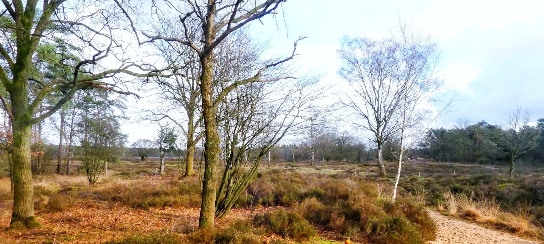
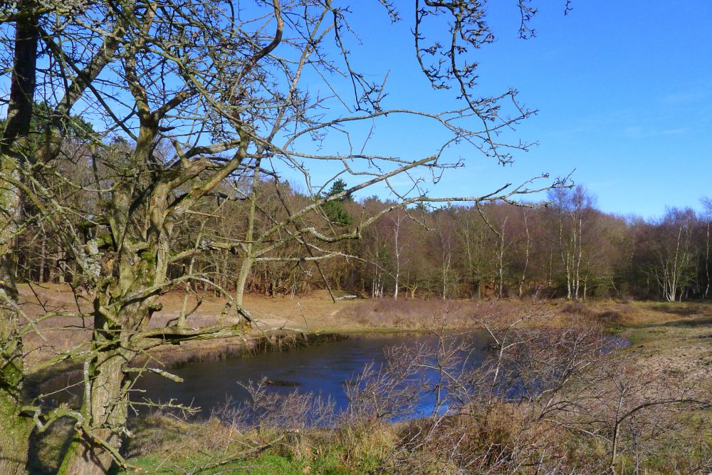
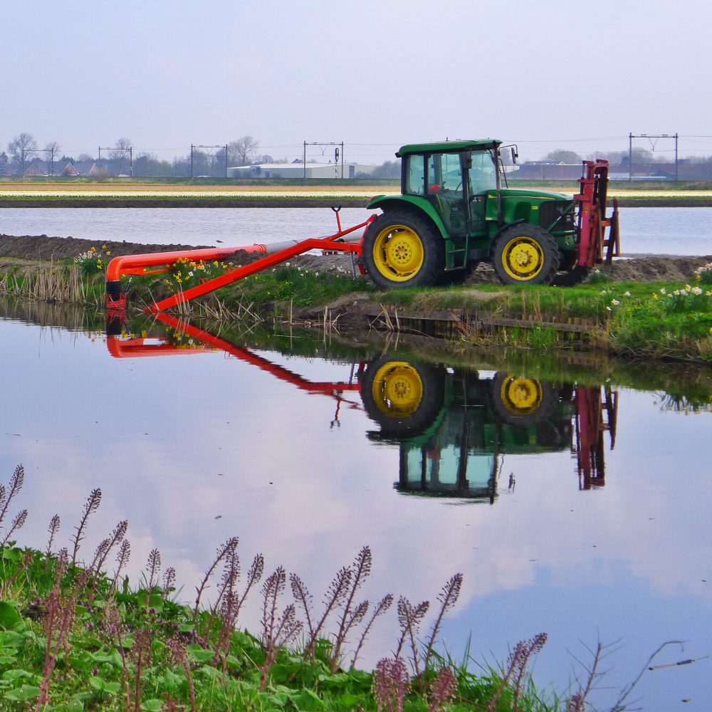
The route generally includes polder landscape (flat land with little flows or canals through meadows or farming land). After a while you come across the Keukenhof. The difference with the flowers in the fields is that the Keukenhof has more different sorts of flowers and flowers which are more rare. The Keukenhof can be so full with visitors  that you have to go in rows through the park, no fun. However, they open until late in the evening, so if you get there by 18 o’clock you still have 1,5 hours for the visit which is long enough, and then the crowd is mostly gone. My experience is that on weekdays during these hours it is a very relaxed and quiet visit.

Landscape near Sassenheim

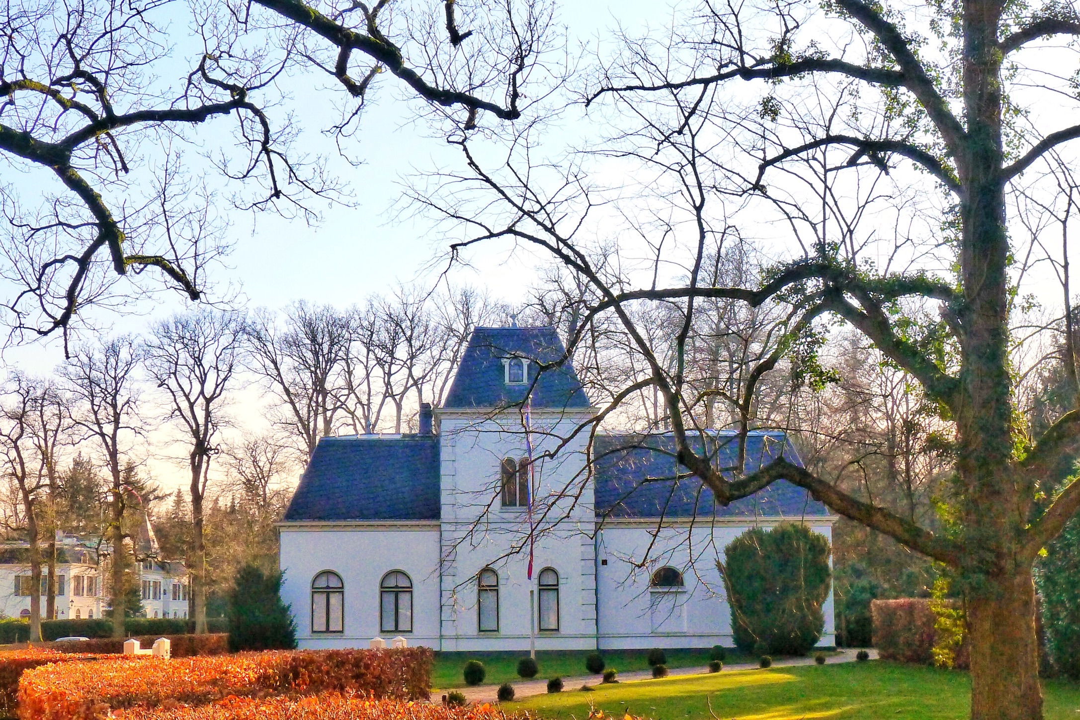
Next to the park there is the Keukenhof Estate with its castle and park around it (completely different from the flower park), also a good stop and clearly not as overwhelmed with visitors as the Keukenhof is.

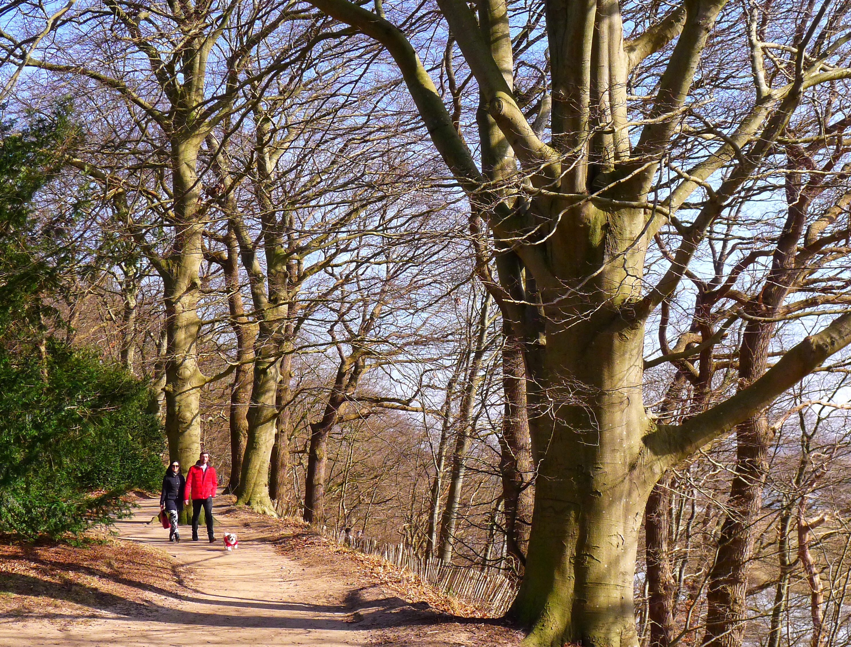
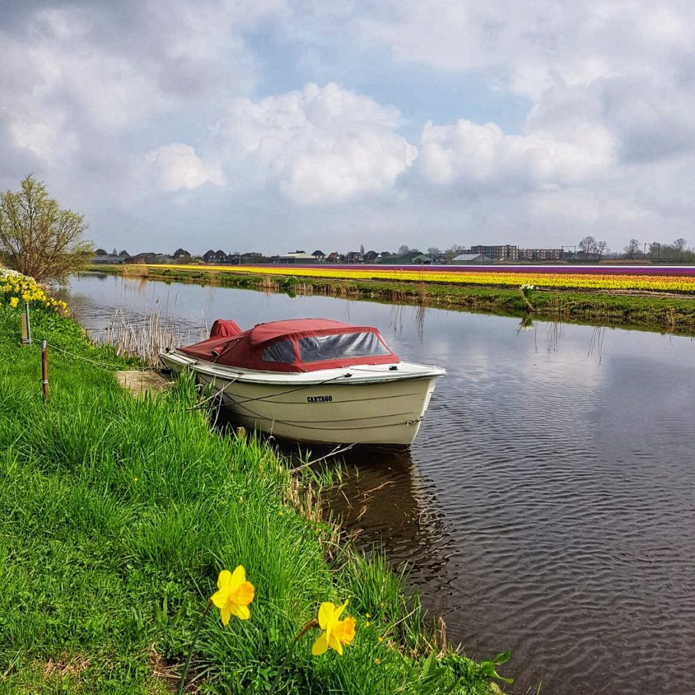
The route continues through flower fields and polder landscape and also crosses Hillegom and again passes the Keukenhof. Just after that you enter Lisse. Most of the terraces can be found here where you can have a good break for lunch but there are lots of other good choices on the route.

Most of the pictures in this article are taken In the close area of the village of Sassenheim but the rest of the route was similar and interesting as well but at some time we simply had taken enough pictures that we didnot want to stop again.

Photo opportunity near Sassenheim
The result!

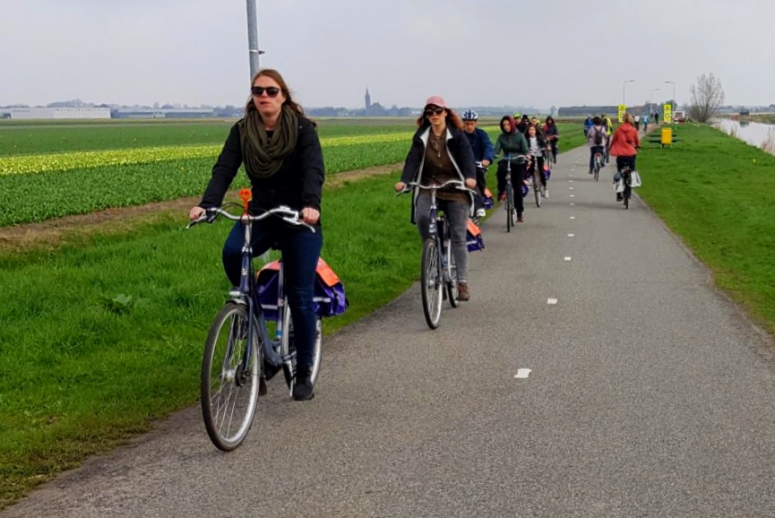
Just a remark as to manage expectations …. The route is very popular and crowded with bikers and all kinds of other type of traffic during the flowering months. Sometimes people even get irritated with others if they want to take that perfect picture but other people are hindering it. You might want to consider a weekday or going very early in the morning on a weekend day. However, are the crowds a reason to avoid this route? No I do not think so, the unique and colorfull views are still well worth it!

The route is very popular and can be very crowded, especially during weekends

General/details:

Origin of the route:  Bollenstreek.nl

Start and Finish: Sassenheim railway station (or any point near/close to the route), nr51 of ‘fietsknooppunt’. See gpx file with route further below. Order of Knooppunten: 51, 50, 58, 55, 57, 38, 07, 49, 40, 48, 11, 44, 15, 16, 17, 18, 94, 21, 13, 28, 40, 49, 29, 91, 30, 41, 54, 25, 51.

Type: circular route

Length: 35 km

Difficulty: easy, no real physical fitness required and no fancy bike needed, a hybride will do fine.

Terrain: flat, bike paths or quiet streets

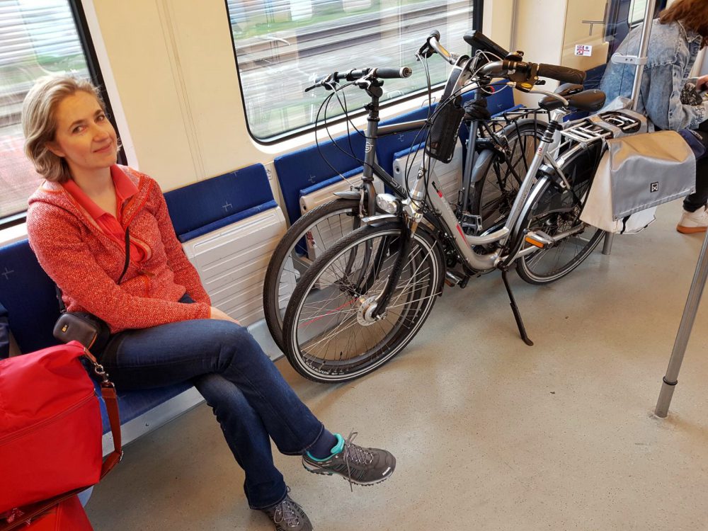
How to get there? By car: you can easily park your car next to the railway station of Sassenheim. Public transport: You can get there by train and it is easily possible to take your bike on the train (~7 euros for 1 day, not possible during the rush hours on weekdays). There are several bike rentals on or close to the route, see for links further below.

Me in the train with our bikes in the designated area

Restaurants underway? Yes, several in Sassenheim, Lisse and Hillegom and further on the route.

Bike rentals:

– Lisse: Bim Bim Bikes;  Café Hotel de Engel; Café Hotel de Nachtegaal

– Hillegom: Bikerental Keukenhof

– Sassenheim: Profile De Fietsspecialist ; Biketotaal Van Hulst +31(0)252222550 (no website available)

Other possible activities underway:

– Keukenhof (flower exhibition gardens): a park with beautiful flower bulb gardens, including the more rare types of flower bulbs. If you want to avoid the crowds, either get there at the opening or late in the afternoon, after 18:00. www.keukenhof.nl

– Keukenhof Estate (castle and park): The castle, of which the first part was built in the 17th century, can be visited, as well as the park surrounding it. The castle itself shows how the nobility lived throughout the last centuries. The park can be visited for free. www.kasteelkeukenhof.nl

– Museum black tulip (‘zwarte tulp’): here you will learn more about the flowerfields region and all that comes with the farming of flowerbulbs. Sometimes additional exhibitions of e.g. paintings of flowerfields. www.museumdezwartetulp.nl

– Dinner made of flower (bulbs), quite unique, in Lisse, only during the flowerfield season between ~mid march until ~mid may. Restaurant de Vier Seizoenen (I found out that the english version of the site is not very informative about their flower menu, the dutch version however is)

Download

Bergen 18km – Groene Wissel

Nature area with sand dunes, heather, forest and beach – March 2018

A highland cow – Bergen aan Zee

Summary

This hike goes through one of my favorite nature areas in the Netherlands, the Schoorlse Duinen. This area is quite extensive and has a lot of variety. It combines sand dunes, which are the highest of the Netherlands, with forest, beach and open heather grounds. The nice village of Bergen lies on the route and is a good place for a lunch stop or a drink on a terrace. Overall we enjoyed this hike very much in the beginning of springtime and we think it is even better in summertime.

Bergen, the old ruin church

Description trail

The hike starts in or close to Bergen, depending on where you park your car or which bus you choose (see general/ details for how to get there). We started just outside the village of Bergen and therefore added the Sparrenlaan to this hike. Originally this is not part of the Groene Wissel hike but definitely worth to go through it. The old Scots pines have become interesting shapes which make this lane very photogenic.

Bergen, Sparrenlaan. Impressive old high Scots pines.

A bit further you enter Bergen, nowadays a touristic spot and often the starting point of hike or bike tours through nature. It is also known for the hub of artists, from painters to writers of poetry. Bergen is claimed to have The Light that enables the creation of beautiful paintings.

In Bergen you pass the old Ruin Church, which was initially built in the 15th century. It was burnt down during the Eighty Years’ War (1568-1648) but later on partially rebuilt.

There are a lot of nice terraces in Bergen so it might be a very good stop for a drink or lunch.

Nature area Schoorlse Duinen

Once you leave Bergen, you enter the pine forest. This forest was planted around 100 years ago. At that time the sand dunes only consisted of very lose sand that was easily controlled by the wind. By planting pine trees and marram grass the dunes became a solid barrier and protection against the sea.

The closer you get to the sea, the more open spaces you will see, with somestimes also heather on it.

Bergen aan Zee beach, horse riding

Almost halfway the trail you enter the beach on which you continue the hike for ~3,5 kms. The beach is quite wide and nice. You will see people letting their dogs but also a lot of horseriders who can go very fast in this big open space. I think this place is very photogenic and therefore a good place to take pictures.

Bergen aan Zee beach, a photogenous place

In the summertime, or often already starting beginning of April, the beach tents are open for a drink or something to eat. We were there end of March and they were still busy rebuilding those tents for the new season.

At the end of the beach the path goes back into the dunes again and you can see the village Bergen aan Zee just on the side of it. There we came across the impressive highland cow which even posed for me.

Me in the pine forest in the Schoorlse Duinen nature area.

The hike then continues through the beautiful Schoorlse Duinen with its open spaces and dunes of lose sand and ends in the pine forest and back at the parking spot.

General/details:

Overview of the route Bergen 18km – Groene Wissel. For the gpx file please see further below

Start and Finish: Bergen center of the village

Type: circular route

Length: 18 km

Difficulty: easy

Terrain: mostly sandpath, sometimes very lose sand, hills of  25-30 height difference.

How to get there? By car: you can easily park your car in Bergen, at parking place Binenhof, but is expensive and can cost you as much as 1,90 EUR per hour. However, we found a free parking spot on the Eeuwigelaan, just outside Bergen (see map). Public transport: You can also get there by bus, several buses go to Bergen, e.g. nr 6 which comes from Alkmaar, busstop Bergen-Plein.

Restaurants underway? Yes, close to the starting/finish point in Bergen and during april-september also halfway on the beach. Alternatively, you can go slightly off track and find restaurants in Bergen aan Zee, next to the beach.

Download

Medemblik 14 km – Groene Wissel

Medemblik historical centre, along the Ijsselmeer shore and through the polder (Grote Vliet nature area) – March 2018

Medemblik, harbour

Summary

This Groene Wissel trail is a nice combination of the old historical centre and picturesque harbour of Medemblik, the shore with views over the Ijsselmeer followed by the Grote Vliet area which is a bird’s paradise. The last part of the trail (several kilometers) were less interesting since it followed a broader asphalt road and a not so appealing neighborhood of Medemblik. I think you can combine this hike very well with lots of fun additional activities, e.g. going with the Steam tram, enjoying a drink on a terrace in picturesque Medemblik, play minigolf in Medemblik or pay a visit to the Steam Engine Museum and Castle Radboud. Overall we enjoyed the hike.

Medemblik, Koningin Emmapark, the home of a few lamas.

Description trail

The trail starts at the Steamtram station and first goes through the historical part of Medemblik. This little town dates back from before the middle ages and there are a lot of houses with old facades. The route continues through the harbour with its small private yachts.

Medemblik, along the Ijsselmeer shore

Just before the trail turns to the Ijselmeer shore, it goes through the Koningin Emmapark which is the home of a couple of lamas.

At the time of our hike there, it was freezing cold with a very strong wind. Although the weather didnot feel very comfortable, it created stunning icicles along the shore.

Medemblik, icicles along the Ijsselmeer shore

Some parts of the dike were very icy, however, alternatively you can go through the park or the grass next to it if it is too slippery. There were a lot of seabirds that could be watched from the shore. During summertime, in some spots along the shore, swimming is possible and you can even sunbath on the little beach. However, at the time we were there, only people wearing extremely warm clothes dared to hike along the shore.

Medemblik, Dutch Steam Engine Museum (Nederlands Stoommachinemuseum)

Almost halfway you enter the village Onderdijk where you can have a break for a simple lunch or a drink in Cafe Restaurant De Welkomst. We enjoyed our lunch there and we were very pleased with the friendliness of the lady who worked there.

Grote Vliet, nature area, birds’ paradise

After Onderdijk, the trail enters the nature area of the Grote Vliet. In case you like birding you definitely should bring a camera with telelens or binoculars since this will be generously rewarded. I only brought my small camera which had battery difficulties because of the cold so it was hard to take pictures anyway.

A door in picturesque Medemblik

After the nature area, the hike becomes less interesting but still has some nice spots like the old windmill on the Brakeweg. The hike ends in Medemblik with its nice harbour and picturesque houses of the old city centre. There, in summertime, it can be very lively with lots of terraces, a perfect end to this hike.

General/details:

Overview Medemblik 14 km Groene Wissel trail. For the gpx file see further below

Start and Finish: Medemblik, steamtrain railway station

Type: circular route

Length: 14 km

Difficulty: easy

Terrain:  sand path and asphalt, flat

How to get there? By car: you can park your car next to the steamtram station. Alternatively, if this spot is full, there is free parking on the road outside the historical center and then you might need to walk at maximum a couple of hundred of meters to the start. Public transport:  Near the Steamtram station, the busstation is located. Different busses (numbers 139, 239, 415) come from Hoorn which has a trainstation.  You can also get there by steamtram coming from Hoorn or take the ferry from Enkhuizen (see links further below)

Restaurants underway? Yes, close to the starting/finish point in Medemblik and halfway in Onderdijk.

Additional activities underway:

– Steamtram: an old steam tram runs from Hoorn to Medemblik and vice versa. This tram runs from april until november. www.stoomtram.nl/en

– Ferry Enkhuizen-Medemblik: an authentic ferry runs between Enkhuizen and Medemblik and can be well combined with a ride in the old steamtram. The ferry usually runs from april until november. www.mstplanner.nl 

– Minigolf in Medemblik: next to restaurant Koekenbier in Koningin Emmapark in Medemblik. www.grill-restaurant-koekenbier.nl/midgetgolf/

– Castle Radboud: for a drink / lunch or an exhibition about the middle ages. At the time of our hike it was closed for renovation activities but it should reopen again  in Spring 2018. www.kasteelradboud.nlwww.kasteelradboud.nl

– Steam engine museum: here you can learn all about steam engines and watch it working. www.stoommachinemuseum.nl/english/

Download

Amsterdamse Waterleidingduinen 12,5 km

Lots of deer at close distance – Amsterdamse Waterleidingduinen

Deer and sometimes foxes in beautiful dunes – March 2018

Summary

Hiking in the Amsterdamse Waterleidingduinen is one of my favorite activities. I like the landscape of dunes mixed with forest but even more the almost 100% chance to see wildlife, at least deer but also possibly foxes. It is a great place to take pictures, so do not forget to bring your camera! The route described follows wider asphalt roads, trails next to the canals but also small sandpath trails that are slightly harder to hike. They all have their charms and bring variety to the hike. Highly recommended!

Description trail

Amsterdamse Waterleidingduinen

The hike starts at the entrance Oase where you can buy your ticket to enter the park (1,50 eur each person). The first part of the trail follows a wide sandpath. Usually, close to the entrance, you will see a lot of other visitors since the park is very popular.

A deer in the Amsterdamse Waterleidingduinen

Once the hike turns into a smaller trail, it gets more quiet and the chance of seeing deer becomes much higher. The pictures of deer in this blog were taken with a digital srl camera with a 75-300mm lens combined with a tripod. I would recommend to take at least a 200 mm (zoom)lens with you in order to be able to make close ups. The deer are not extremely shy but when you get closer than ~20-30 metres they will run away.

Footpath in the Amsterdamse Waterleidingduinen

This time while hiking in the Waterleidingduinen we didnot see any foxes but 1 out of ~5 times that I hiked there I did see some, so next time better luck.

Deers in the Amsterdamse Waterleidingduinen

During the trail you will notice that the water in the canals of the dunes is cristal clear. This water is used for drinking water and the sand of the dunes works as a filter to further clean the water. 70 million m3 of water is filtered in these dunes on a yearly basis and this water makes up 2/3 of the drinking water in Amsterdam.

A canal in the Amsterdamse Waterleidingduinen

The park itself is only accessible for hikers and not for bikers or cars. This makes it a very quiet and attractive park for hiking. Further, it is allowed to go outside the trails which you might want to in order to get that really “wow” picture!

General/details:

Map of the trail, further below you can download the gpx file

Start and Finish: Entrance Waterleidingduinen at Oase, Vogelenzang. At the entrance you will need to buy a ticket of 1,50 Eur as a fee for the park.

Type: circular route

Length: 12,5 km

Difficulty: easy

Terrain: mostly sandpath, some asphalt trails, small hills (not more than 30-50 meters high)

How to get there? By car: you can easily park your car next to the entrance Oase, which costs you 2,- Eur parking fee.  Public transport: You can also get there by bus, nr 9, stop “Vogelenzang, Waterleiding” (this bus comes from trainstation Heemstede-Aerdenhout.). The busstop is located ~150 meter from the entrance of the parc.

Restaurants underway? Only at the starting/finish point, restaurant “Uitspanning de Oase”.

Download


Wageningen 10km

Beautiful trail combining river landscape,  arboretum, forest and views over the river valley – March 2018

Wageningen, uiterwaarden

Summary

This hike combines a diverse range of landscapes, like the river valley and views on it, the arboretum which is lovely to visit when the flowers are blooming and a park and forest. It can also be combined with a visit to the vineyard and during some weekends with a visit to the old stone factory to see the work of it’s artists (for links see further below). Since this is a very popular area for hiking because of its beauty, this is not a very quiet trail. Nevertheless, because of its diversity and beauty, we enjoyed it very much so I can well recommend it!

Wageningen, iceskating on the uiterwaarden

Description trail

The route starts at the dike where you enter the “uiterwaarden”. This is a piece of land that is overflown by water from the river Nederrijn in case there is high water during the winterseason. Here there are nice river landscape views.

Wageningen, hiker’s bridge

During our hike beginning of March, there was still a bit of ice on the water and people were enjoying iceskating.

After a while, a little hiker’s bridge brings you to the other side of the flow where the trail further continues along the river Nederrrijn. There you pass the old stone factory dating from 1923 which is now in use by artists. they open up to the public during some weekends.

Wageningse Berg, park overlooking the river valley

The hike then continues towards the Wageningse Berg, a hill that is well visible from the riverside. A small climb of around 50 metres brings you up the hill and there you enter the Belmonte Arboretum, a beautiful botanical garden. The garden is open to the public for free. The Arboretum used to be an estate founded around 1845. During the second world war, the estate’s buildings were heavily damaged and nowadays the botanical garden is the remainder.

View on Renkum from the Wageningse Berg

A bit further on the trail you have a fantastic view over the river valley, which is even better at the terrace of the hotel restaurant the Wageningsche Berg where we had our short stop for a drink. This terrace is very popular on sunny days, even on those days during wintertime it might be difficult to get a table.

Wageningse berg, horse riding

The hike then goes further on the hill and continues into a forest. A bit further the hike passes the small Vineyard of the Wageningse Berg, which was started in 1998.

Wageningse Berg, vineyard

According to their website, during the summer months every saturday at 16 o’clock, you can get a tour through the vineyard. For other activities and links see further below.

The hike further continues through a part of Wageningen, enters the Arboretum again and goes via the dike where you get back to the start of the route.

Wageningse Berg, view on the Holleweg

The center of Wageningen is close to the start and finish point. It is a good place to have a drink or lunch/dinner in one of the many nice bars or restaurants. On sunny days in spring or summer there are lots of terraces and a good atmosphere.

General/details:

Overview of the Wageningen trail

General remark: the first part of the route may not be accessible during some weeks in wintertime due to high water of the river Nederrijn.

Start and Finish: At the crossroad of Dijkstraat/Grebbedijk in Wageningen

Type: circular route

Length: 10 km

Difficulty: easy

Terrain: sandpath and asphalt. There is a hill to climb which measures ~ 50 metres.

How to get there?      By car: Parking can be done in Wageningen. There are a couple of public parkings in Wageningen, ~500 metres away from the starting point: Hoogvliet parking at Vandaring 9, Wageningen and parkings at Costerweg 9 or Walstraat 40 in Wageningen, for all 3 a parking fee is required. You could also consider to park at the hotel De Wageningsche Berg, which is at ~4km of the route but you might need to be a guest of the hotel or restaurant in order to be able to park there.                    Public transport: You can also get close by the starting point by bus, nr 50 at busstop Hof van Gelderland in Wageningen which is about 250 metres away from the starting point.

Restaurants underway? Yes, at ~4 km there is Hotel restaurant De Wageningsche Berg at the Generaal Foulkesweg in Wageningen www.hoteldewageningscheberg.nl. In Wageningen itself there are many restaurants and bars, just a couple of hundred of meters away from the starting and finish point.

Other activities underway:

– The old stone factory, artists’ work:  www.steenfabriekwageningen.nl

– Belmonte arboretum: wwww.belmontearboretum.nl

– Vineyard Wageningse Berg: http://www.wageningswijngoed.nl

Download

Leusden 14,5 km

Beautiful forest hike with lots of open spaces, through estate Den Treek-Henschoten – february 2018

Den Treek-Henschoten: a diverse forest with lots of open spaces

Summary

This is a nice route through nature area, mainly forest with open spaces filled with heather, grass, fens and peat. The forest consists of a diverse combination of type of trees, eg different conifers and decidious forest. The hike mainly crosses the estate Den Treek- Henschoten, a private nature area which is open to the public for free. Overall, a very enjoyable trail through the forest.

Even in wintertime an enjoyable hike

Description trail

The route is derived from the book “Wandelen over de Utrechtse Heuvelrug” by Rob Wolfs and Ad Snelderwaard, hike nr6, with just a small change to it (we took a small path in parallel to the originally intended trail for a few hundred meters).

The start of the hike, the parking lot, is already half in the forest, close to Leusden-zuid.  Most of the hike goes through a fine forest with here and there an open space.

Sometimes the open spaces are filled with grass, other times with heather, fens and peat with here and there a tree.

Grass, peat and a fen in the low wintersun make a pretty image

For a considerable part the path crosses the estate Den Treek – Henschoten, a wide area, which is private property but luckily open to the public. More towards the end of the hike you can see the buildings of the estate which are rather pretty.

Part of the estate Den Treek – Henschoten

There we came across a couple of beatiful and friendly horses that walked towards us.

Part of the estate Den Treek-Henschoten
Rob being greeted by the horses

Overall we truly enjoyed the hike since it was a nice variation of fine forest and a diversity of open spaces.

General/details:

Overview of the route. For the gpx file see further below.

Start and Finish: Parking lot Leusden Zuid

Type: circular route

Length: 14,5 km

Difficulty: easy

Terrain: almost completely forest path, flat

How to get there? By car: you can easily park your car for free at the parking lot. Public transport: You can also get there by bus (nr 280, exit Leusden Bavoort) but then you will need to hike 500-1000 meter to the start of the route.

Restaurants underway? No, you will need to bring your own drinks and snacks.  However, there is a restaurant close to the start/finish, 500-1000 meters away (restaurant Bavoort).

Download

Amersfoort 18km

City hike with parks and forest, february 2018

Amersfoort, Randenbroek park

Summary

This hike combines a tour through the historical town Amersfoort with parks and forest. It is more a tour through town (almost 70%) combined with a piece of forest (30%). Amersfoort has a beautiful historical centre, parks and neighbourhoods with well designed villas, however a part of the tour through town I found less interesting. The piece of forest that is included is nice but not extremely beautiful. The hike can be combined with a tour on the Onze Lieve Vrouwe Tower, the Koppelpoort or Kamp Amersfoort (see details further below). Overall a hike with some nice features but also with less interesting parts.

Amersfoort – view on historical centre

Description trail

This hike follows the route nr 5 from the book “Wandelen over de Utrechtse Heuvelrug” by Rob Wolfs and Ad Snelderwaard. The hike starts at the parking place just outside of Amersfoort (in case you use public transport, you can start the hike at the Amersfoort railway station).

The first part begins in the forest and, via a neighbourhood of Amersfoort, turns into a chain of a couple of city parks. Especially the park Randenbroek we found very beautiful.

A little bit later, you enter the old city center. Amersfoort is an old town that existed already in the middle ages. Its historical centre has been well preserved and is worth visiting. Some of the portals and walls of the old town still exist. There are lots of terraces and restaurants which make a perfect break after 1 hour of hiking. We had our lunch in “In den Kleinen Hap”, a nice old cosy place.

Amersfoort – Koppelpoort in the distance

A possible additional activity is to climb the Onze Lieve Vrouwe tower of almost 100 meters high. It dates from the 15th century and provides good views over Amersfoort.  It is sligthly off trail but close to it in the old centre, see further below for details.

The trail continues through the old city center, along the church and the market place and exits the historical center via the Koppelpoort, which dates from the 15th century. It can be visited upon request (for details see further below).

The route then continues via the Eemplein, a new shopping and entertainment centre, and a couple of neighborhoods. This part of the trail was actually less interesting.

The watchtower of Kamp Amersfoort

We crossed the railway via the central railway station (for which you need to bring your ov chipcard, otherwise you cannot go through the fences). The neighbourhoods that follow are with nice big villas, some old and some recently built, mostly with beautiful architectural features.

Later on, the hike continues via parks and a golf resort. After a while you pass Kamp Amersfoort, a transit camp by the nazis during the second world war. The watchtower is one of the few remains of it. The kamp can be visited and each sunday there is a guided tour (see “general details” for a link).

Forest path outside of Amersfoort

The hike continues over the highway into the forest. After a while, the trail ends on the parking space at the beginning of our trail.

General/details:

Overview of the trail Amersfoort 18km. For the gpx file see further below.

Start and Finish: Parking lot or central railway station Amersfoort

Type: circular route

Length: 18 km

Difficulty: easy

Terrain: mostly asphalt and forest path, flat with ~40 meters difference in height on the overall route.

How to get there? By car: you can easily park for free at the parking lot. Don’t forget to bring your ov chipcard which you need in order to cross the railway via the central railway station in Amersfoort. Public transport: You can also get there by train (the route will then have another starting point)

Restaurants underway? Yes, lots of restaurants in the historical centre, further, a couple of restaurants spread over the route.

Additional activities underway:

– Onze Lieve Vrouwe Tower: guided tours every day. www.gildeamersfoort.nl/torenbeklimmingen/

– Koppelpoort: guided tours of ~30 minutes upon request. www.gildeamersfoort.nl/rondleidingen/de-koppelpoort/

– Kamp Amersfoort:  For info, general opening times and fees see www.kampamersfoort.nl

Download

Baarn ~16km

Forest combined with the Groeneveld estate ~16km, 11 february 2018

Groeneveld castle

Summary

This trail mostly goes throug forest area with in addition the park of estate Groeneveld, the Stulp area (open space with grass, heather and charolais cows) and a small part through the little village of Baarn with its nice villas. Overall a nice hike through forest nature area.

Description trail

This route starts at the railway station in Baarn and follows the route indicated in the book “Wandelen over de Utrechtse Heuvelrug” by Rob Wolfs and Ad Snelderwaard. We changed the start of it slightly since my friend wanted to find a geocache close to the old bridge over the railway. We didnot find it so if someone knows how to get it, please send me an email about it!

The route continues first through Baarn and then turns into a diverse forest.

Forest path near Baarn

Already at 4 kms you enter the Groeneveld Estate where you can drink or eat something in the very nice restaurant. At the time that we were there, on it’s terrace you could even roast marshmellows over a fire. The estate itself is a well contained park with a pond and hiking trails.

Groeneveld Estate

The hike continues into the forest. We made a little mistake on the route but were able to correct it shortly.

More close to the end of the hike, in the forest there is the open space “the Stulp” with heather, and this adds variation to the hike. On the Stulp, you can find charolais cows whose presence  ensures that the open space remains an open space. Unfortunately they hid far away from our trail.

The Stulp

At the end you go through an area of Baarn with villas built during 1910-1930 and these have interesting features like little towers. The trail ends at railway station Baarn where there is the possibilty for a drink or dinner. We finished our hike in “the Generaal”, a cosy place next to the station.

General/details:

Overview of the route Baarn 16 km. See for gpx file further below.

Start and Finish: Baarn railway station

Type: circular route

Length: 16 km

Difficulty: easy

Terrain: mostly sandpath, flat

How to get there? By car: you can easily park your car for free next to the railway station. Public transport: You can also get there by train.

Restaurants underway? Yes, at the starting/finish point and at 4km (Groeneveld estate). Recommended: in Baarn, next to the railway station, De Generaal, daily open from 10 a.m. www.degeneraal.nl. and on estate Groeneveld, www.grandcafegroeneveld.com, open tuesday-sunday from 11:00-17:00.

Download

Noordwijkerhout ~8km

Forest, dunes and beach, 14 february 2018

Noordwijkerhout beach

A nice stroll which starts in a forest and goes via the dunes to the beach. On the beach you can see the skyline of Noordwijk in the distance.

Noordwijkerhout, dunes

During wintertime, no beachclub has opened yet on this route. If you want to go for a drink, the Fletcher Hotel Restaurant “de witte raaf” is located close to the parking lot.

Noordwijkerhout, forest with totem poles

In the forest there are lots of trails and some of these contain interesting totem poles.

General/details:

Overview hiking trail Noordwijkerhout 8km, see for gpx file further below

Start and Finish: Noordwijkerhout, parking lot “Duindamseslag”.

Type: circular route

Length: 8 km

Difficulty: easy

Terrain: mostly sandpath, flat with some 20m hills

How to get there? By car: you can easily park your car on the parking lot “Duindamseslag”, no fees to be paid. No public transport close by.

Restaurants underway? Yes, close to the starting/finish point. On the beach restaurants are only open during the season ~april until ~october.

Download

Castricum ~10 km

The Pancake-Forest route, ~10 km

Castricum forest area

Summary

Nice forest area if you like to hike for a couple of hours and happen to be in the area. Recommended for spending an afternoon in the forest, however, I wouldnot recommend to travel much time for it since there are many of such nice forest areas in the Netherlands, possibly closer by than this one.

Description trail

The route starts at the railway station of Castricum and enters the forest already after 5-10 minutes of hiking. Initially we tried to hike the “groene wissel”-route as described in the book “Groene Wissels, Noord Holland, 20 wandelingen” by Bart van der Schagt. However, just after entering the forest we found a little route block and got lost from the route.

Castricum forest area

Nevermind, the forest is very nice with many different paths so we decided to take the best looking path that pointed more or less towards the restaurant “Johanna’s Hof” and enjoyed the hike.

Most of the route is a nice forest with now and then open spots. The restaurant was halfway of the total route and the pancakes tasted delicious.

A delicious pancake at Johanna’s Hof

After the restaurant we could mostly follow the intended groene-wissel route again.

Overall, a nice forest hike for a sunny winterday.

Overview trail Castricum 10 km

General/details:

Start and Finish: Castricum railway station

Type: circular route

Length: 10 km

Difficulty: easy

Terrain: mostly sandpath, flat

How to get there? By car: you can easily park your car next to the railway station. Public transport: You can also get there by train.

Restaurants underway? Yes, at the starting/finish point and halfway. Recommended halfway for a pancake, www.johannashof.nl open daily for lunch and dinner.