Leusden 14,5 km

Beautiful forest hike with lots of open spaces, through estate Den Treek-Henschoten – february 2018

Den Treek-Henschoten: a diverse forest with lots of open spaces

Summary

This is a nice route through nature area, mainly forest with open spaces filled with heather, grass, fens and peat. The forest consists of a diverse combination of type of trees, eg different conifers and decidious forest. The hike mainly crosses the estate Den Treek- Henschoten, a private nature area which is open to the public for free. Overall, a very enjoyable trail through the forest.

Even in wintertime an enjoyable hike

Description trail

The route is derived from the book “Wandelen over de Utrechtse Heuvelrug” by Rob Wolfs and Ad Snelderwaard, hike nr6, with just a small change to it (we took a small path in parallel to the originally intended trail for a few hundred meters).

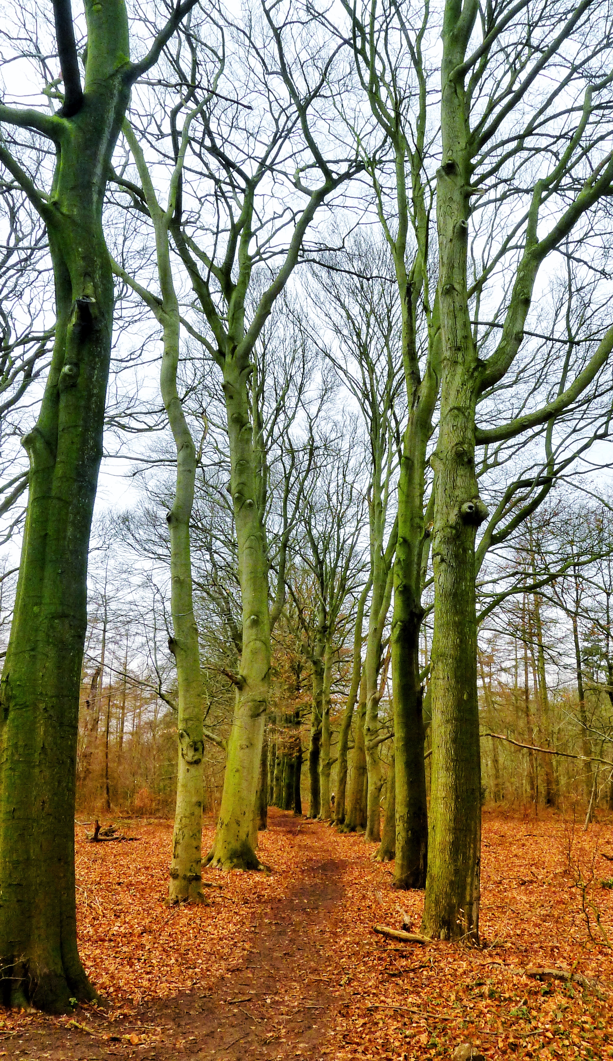
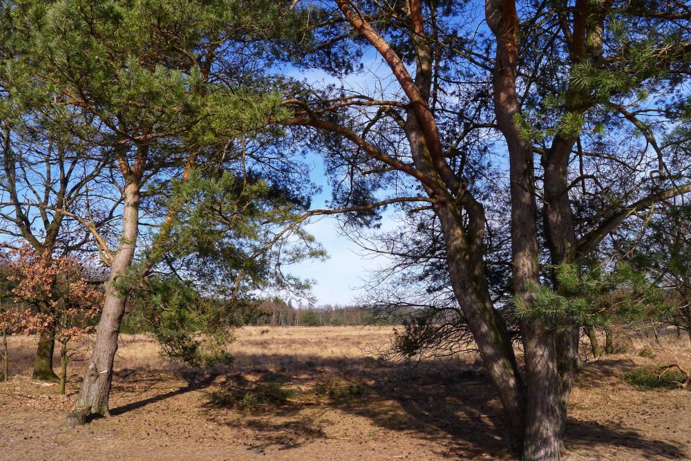
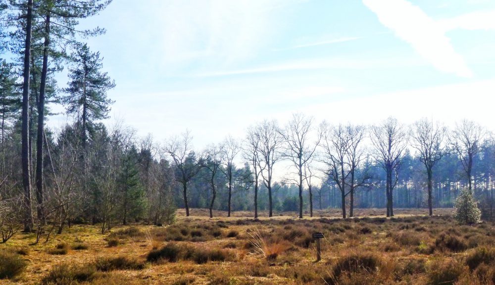
The start of the hike, the parking lot, is already half in the forest, close to Leusden-zuid.  Most of the hike goes through a fine forest with here and there an open space.

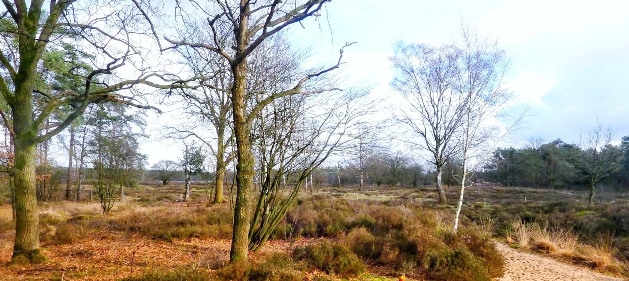
Sometimes the open spaces are filled with grass, other times with heather, fens and peat with here and there a tree.

Grass, peat and a fen in the low wintersun make a pretty image

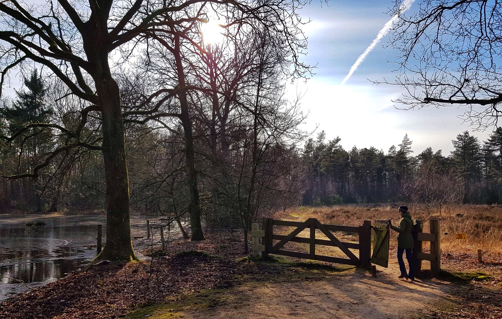
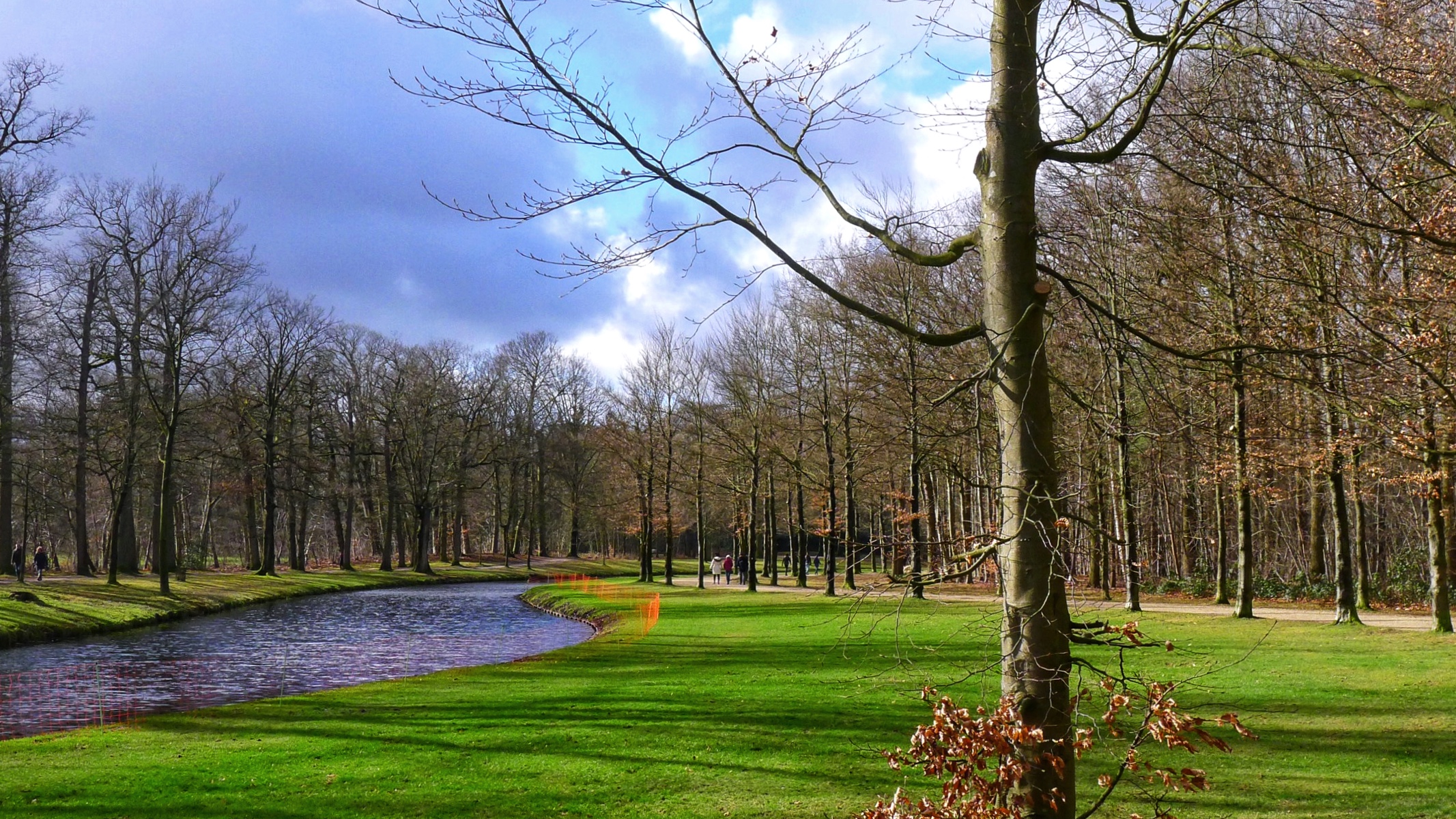
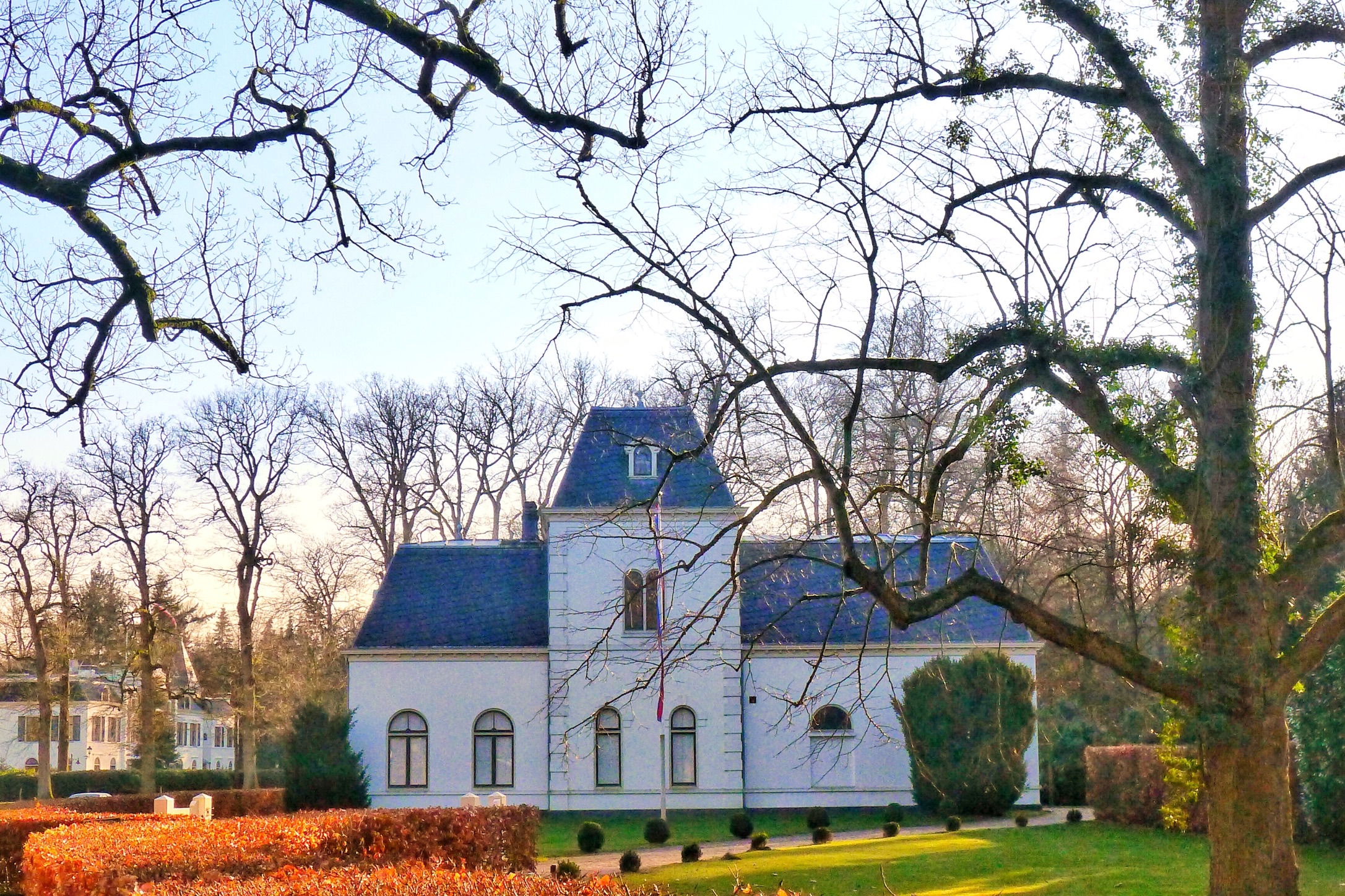
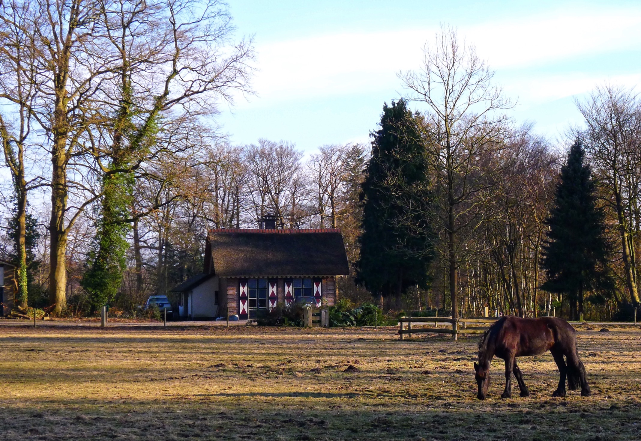
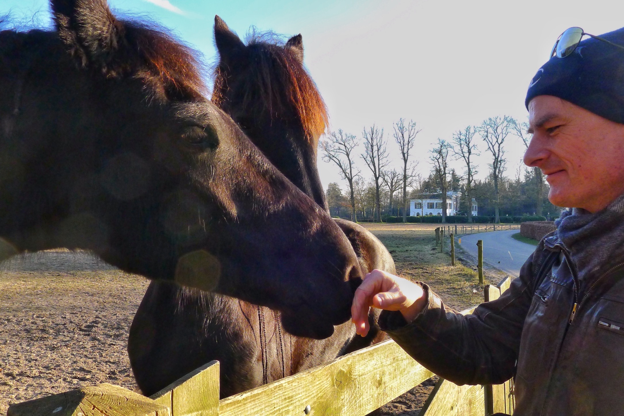
For a considerable part the path crosses the estate Den Treek – Henschoten, a wide area, which is private property but luckily open to the public. More towards the end of the hike you can see the buildings of the estate which are rather pretty.

Part of the estate Den Treek – Henschoten

There we came across a couple of beatiful and friendly horses that walked towards us.

Part of the estate Den Treek-Henschoten
Rob being greeted by the horses

Overall we truly enjoyed the hike since it was a nice variation of fine forest and a diversity of open spaces.

General/details:

Overview of the route. For the gpx file see further below.

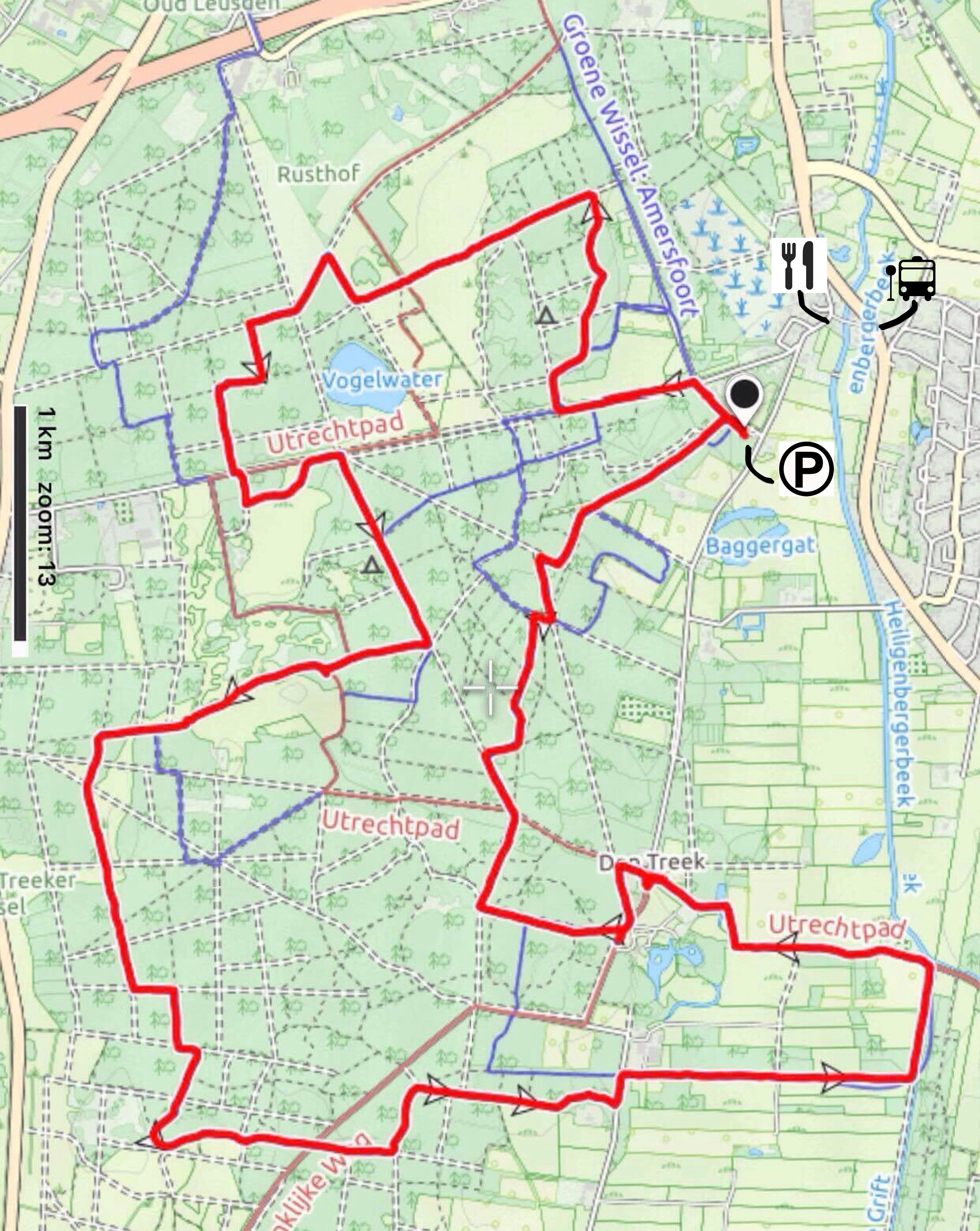
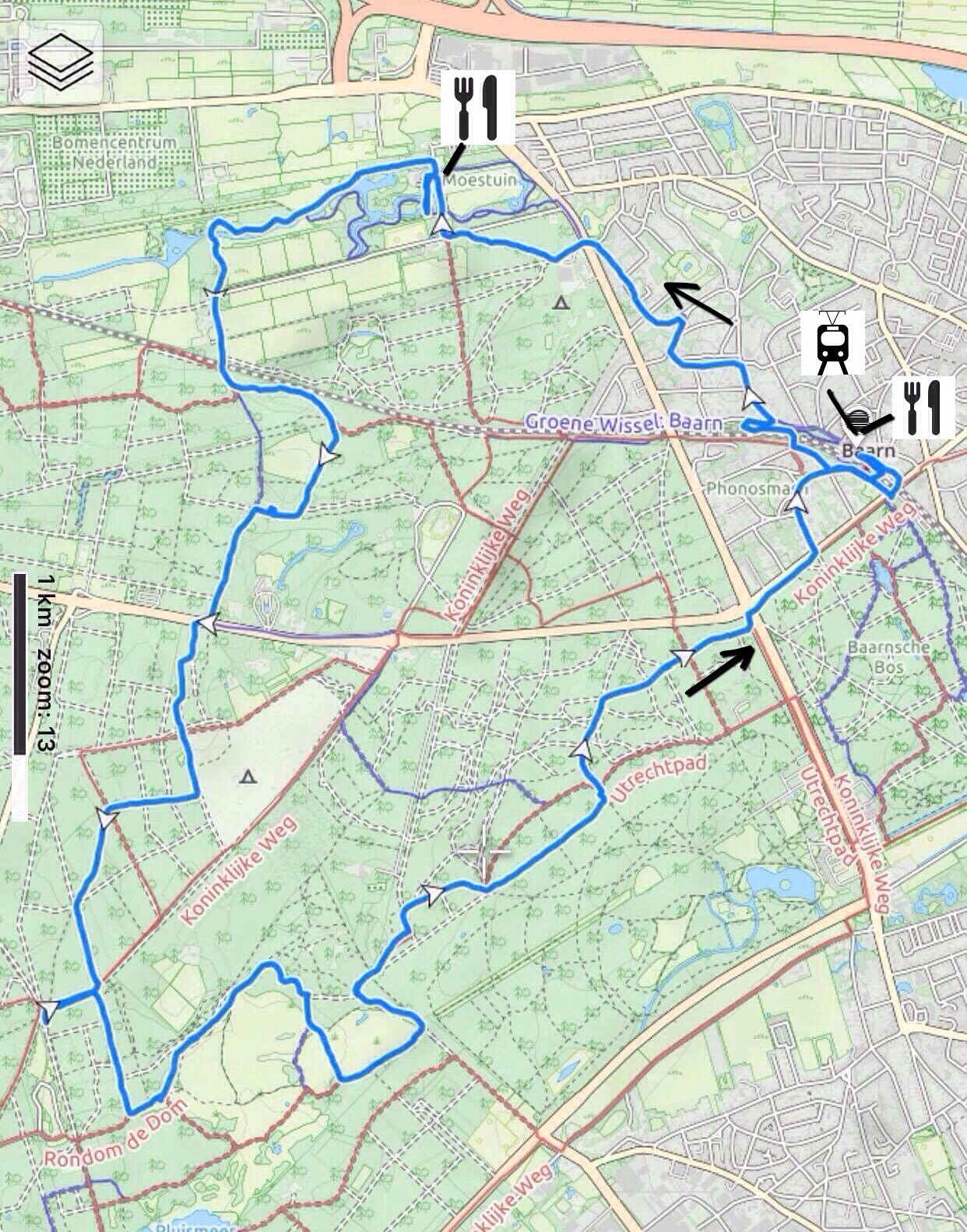
Start and Finish: Parking lot Leusden Zuid

Type: circular route

Length: 14,5 km

Difficulty: easy

Terrain: almost completely forest path, flat

How to get there? By car: you can easily park your car for free at the parking lot. Public transport: You can also get there by bus (nr 280, exit Leusden Bavoort) but then you will need to hike 500-1000 meter to the start of the route.

Restaurants underway? No, you will need to bring your own drinks and snacks.  However, there is a restaurant close to the start/finish, 500-1000 meters away (restaurant Bavoort).

Download

Baarn ~16km

Forest combined with the Groeneveld estate ~16km, 11 february 2018

Groeneveld castle

Summary

This trail mostly goes throug forest area with in addition the park of estate Groeneveld, the Stulp area (open space with grass, heather and charolais cows) and a small part through the little village of Baarn with its nice villas. Overall a nice hike through forest nature area.

Description trail

This route starts at the railway station in Baarn and follows the route indicated in the book “Wandelen over de Utrechtse Heuvelrug” by Rob Wolfs and Ad Snelderwaard. We changed the start of it slightly since my friend wanted to find a geocache close to the old bridge over the railway. We didnot find it so if someone knows how to get it, please send me an email about it!

The route continues first through Baarn and then turns into a diverse forest.

Forest path near Baarn

Already at 4 kms you enter the Groeneveld Estate where you can drink or eat something in the very nice restaurant. At the time that we were there, on it’s terrace you could even roast marshmellows over a fire. The estate itself is a well contained park with a pond and hiking trails.

Groeneveld Estate

The hike continues into the forest. We made a little mistake on the route but were able to correct it shortly.

More close to the end of the hike, in the forest there is the open space “the Stulp” with heather, and this adds variation to the hike. On the Stulp, you can find charolais cows whose presence  ensures that the open space remains an open space. Unfortunately they hid far away from our trail.

The Stulp

At the end you go through an area of Baarn with villas built during 1910-1930 and these have interesting features like little towers. The trail ends at railway station Baarn where there is the possibilty for a drink or dinner. We finished our hike in “the Generaal”, a cosy place next to the station.

General/details:

Overview of the route Baarn 16 km. See for gpx file further below.

Start and Finish: Baarn railway station

Type: circular route

Length: 16 km

Difficulty: easy

Terrain: mostly sandpath, flat

How to get there? By car: you can easily park your car for free next to the railway station. Public transport: You can also get there by train.

Restaurants underway? Yes, at the starting/finish point and at 4km (Groeneveld estate). Recommended: in Baarn, next to the railway station, De Generaal, daily open from 10 a.m. www.degeneraal.nl. and on estate Groeneveld, www.grandcafegroeneveld.com, open tuesday-sunday from 11:00-17:00.

Download